


Yucca Voting District, Shawnee County, Kansas
About
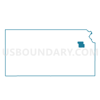
Outline

Summary
| Unique Area Identifier | 587378 |
| Name | Yucca Voting District |
| County | Shawnee County |
| State | Kansas |
| Area (square miles) | 4.49 |
| Land Area (square miles) | 4.41 |
| Water Area (square miles) | 0.08 |
| % of Land Area | 98.14 |
| % of Water Area | 1.86 |
| Latitude of the Internal Point | 38.97672580 |
| Longtitude of the Internal Point | -95.84456550 |
Maps


Graphs
Select a template below for downloading or customizing gragh for Yucca Voting District, Shawnee County, Kansas


Neighbors
Neighoring Voting District (by Name) Neighboring Voting District on the Map
- Buffaflo Voting District, Shawnee County, KS
- Dover Voting District, Shawnee County, KS
- South Mission Voting District, Shawnee County, KS
- Sunflower Voting District, Shawnee County, KS
Top 10 Neighboring County Subdivision (by Population) Neighboring County Subdivision on the Map
- Mission township, Shawnee County, KS (9,365)
- Auburn township, Shawnee County, KS (3,147)
- Dover township, Shawnee County, KS (1,524)
Top 10 Neighboring Unified School District (by Population) Neighboring Unified School District on the Map
- Auburn-Washburn Unified School District 437, KS (34,191)
- Wabaunsee East Unified School District 330, KS (3,186)
Top 10 Neighboring State Legislative District Lower Chamber (by Population) Neighboring State Legislative District Lower Chamber on the Map
- State House District 52, KS (22,542)
- State House District 54, KS (22,524)
- State House District 51, KS (22,133)